ASSOCIATION OF OIL, GAS AND
RENEWABLE ENERGY COMPANIES
OF LATIN AMERICA AND THE CARIBBEAN
ASSOCIATION OF OIL, GAS AND
RENEWABLE ENERGY COMPANIES
OF LATIN AMERICA AND THE CARIBBEAN
ARPEL launches new Guidelines for Monitoring and Inspection of Geohazards in Pipelines
In order to promote the permanent search for operational excellence among its members, the Regional Association of Oil, Gas and Biofuels Sector Companies in Latin America and the Caribbean (ARPEL), launched a new technical publication on the management of geohazards by pipeline operators in the region.
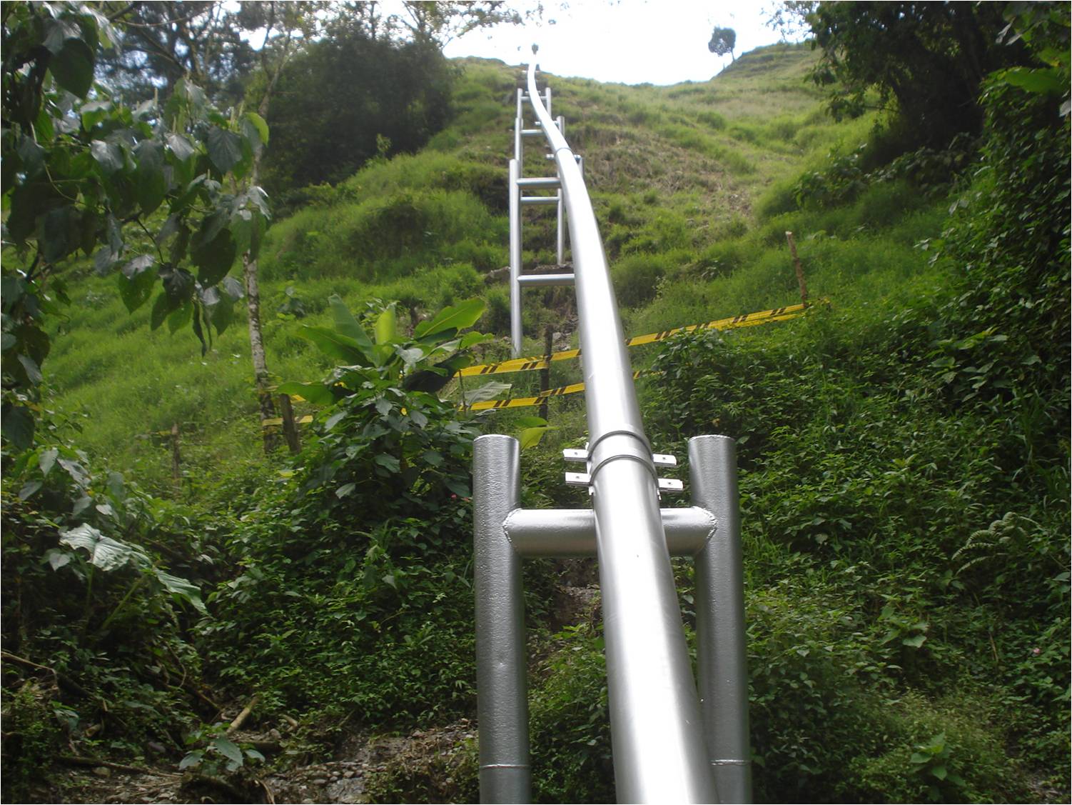
Pipeline systems, a crucial part in the transportation and distribution of oil and gas, can run all along their way through various geological formations, soil types, water flows and also face seismic and hydrological threats (soil creep, geological faults, landslides and flash floods, among others), causing movements between the ground and pipelines.
This is especially critical in Latin America and the Caribbean, where the rates of pipeline failures due to geohazards are much higher than in other parts of the world. For example, in the Andes, the pipeline routes are on steep terrain, tectonically active and subject to heavy rainfall.
In addition to that, the growing impacts derived from climate change make geohazards one of the major risk factors to pipeline integrity in the region.
The expert members of the Geotechnics Project Team, which operates under the ARPEL Pipelines and Terminals Committee, and the authors of the new guidelines, argue that "managing pipeline integrity allows the identification of the various threats to which these assets are subject through prevention and mitigation actions that minimize their consequences on people, the environment and infrastructure."
ARPEL has been working strongly since 2009 in the promotion of excellence in the pipeline integrity management of operating companies in the region, to which end it developed the Reference Manual on Pipeline Integrity Management and subsequently launched the only Training and Accreditation Program on this subject existing in the region.
Aware of the need to continue improving the performance of the sector in this issue, ARPEL decided to gather the knowledge in the management of geohazards of pipeline operators in the region, developing new guidelines that consolidate the knowledge, dispersed until now, in a single document of practical interest, which serves as a reference for those responsible for pipeline maintenance and integrity management.
MONITORING AND INSPECTION OF GEOHAZARDS
The supervision and inspection of the right of way, the strip of land where pipelines are laid, is one of the key aspects to be considered in the monitoring and inspection of geohazards in pipelines. This can be done by means of aerial or ground tours, and should be performed regularly to detect geotechnical events that may cause damage to the pipeline: new construction of roads, ditches, gutters, evidence of spills on the surface and invasions to the right of way.
In addition, the monitoring of variables in the land allows the periodical identification of the existence and activity of natural hazards that could affect pipeline integrity, the operation and durability of the works to protect or reinforce the land, and contribute to the definition of preventive maintenance actions.
Triggering agents are events that can trigger a geohazard, either soil movement or displacement of bodies of water and mud that could affect the pipeline integrity. These can be caused by rain, wind, seismic, volcanic and anthropic activity, and it is necessary to understand the specific characteristics of each one of them, because they induce different responses from the land. This makes it imperative to establish its monitoring by defining Early Warning Systems to alert nearby communities and take other measures required.
Neither should monitoring of the effect of geohazards directly on the pipeline be neglected. This is the primary interest of the operator whose function is to ensure the pipeline integrity. This monitoring may be continuous through the use of online inspection with specialized non-disruptive instruments by external positioning of strain gauges.
Finally, the guidelines would not be complete without considering the use of Geographic Information Systems (GIS), applied for localization, processing, spatial visualization and storage of information related to patrolling and geotechnical monitoring. The ultimate usefulness of the GIS lies in its capacity to develop models.
ARPEL members may download the Guidelines for Monitoring and Inspection of Pipeline Integrity Management to Face Geohazards by clicking here
Av. Luis A. de Herrera 1248. WTC. Tower 2. Floor 7. Of. 717. Montevideo, Uruguay
Ph: (+598) 2623 6993 - E-mail: info@arpel.org.uy


 READ MORE